White River seen from Oliver's Woods

The Late Woodland People of Oliver’s Woods

Part 2 of a series for Native American Heritage Month

Archeological records reveal the presence of very early residents on what is now Oliver’s Woods. Thanks to the Indiana Historical Society, we know that around 1060 AD, Late Woodland people lived at the site. (“Woodland” is the name archeologists use to classify a period of North American pre-Columbian cultures from roughly 1000 BCE to European contact in eastern North America.)

This discovery predates the land trust’s involvement with the property. In 1959, according to the Indiana Historical Society, American Aggregates Corporation was contracted to remove gravel at the site. The site had been on the radar of Indiana archaeologists since the 1930s. So the IHS requested to salvage artifacts before the gravel was mined.

Amazingly, the contractors halted operations and did not resume until 1965, allowing over half a decade for the archeological exploration.

Indiana Historical Society report on the Bowen site

The Bowen site, as it was known then, lay on the north bank of the White River’s west fork. The dig revealed evidence of a settlement about 100 yards away from the river’s edge. Pottery analysis indicated that the site was occupied by people with mixed cultural characteristics of Late Woodland and other late prehistoric peoples. Most likely they were seasonal occupants of the land, feeding themselves by growing maize, fishing, musseling, hunting, and foraging.

While the site was disturbed by 100 years of plowing, the archeologists salvaged tools made of bone, stone, and antler. Artifacts made of mussel shell, burned clay, and copper also provided hints of what life was like here in the 11th century.

Tree species that predominated mirrored those of today’s floodplain forest: silver maple, sycamore, American elm, cottonwood, hackberry, cork elm, box elder, black willow, white ash, and red elm. The understory featured small trees like hawthorn and hop hornbeam, as well as shrubs like elderberry, spicebush, wahoo, and pawpaw.

Animal remains found on the site included species one might expect: an abundance of deer and turkey, as well as many raccoons, squirrels, mice, and woodchucks. A small number of box turtles and snapping turtles were present. Intriguingly, 32 dogs were among the remains.

The site also revealed evidence of mammals no longer found in the region—17 elks, six black bears, four gray wolves, and even one mountain lion—and of birds that have gone extinct (three passenger pigeons).

The researchers suspect that the site was the seasonal home for 50 people for three to five years, or perhaps 100 over a generation, around the year 1060 AD.

There was no evidence of house structures, but the dig revealed refuse pits, burned areas, and several burials. In fact, the archeological team discovered and studied nearly 40 human remains.

It can be disturbing to look at the past through the lens of the present, knowing that academic researchers were unearthing and analyzing human bones from the land that is now Oliver’s Woods. This is also part of the history of the property, and Native American Heritage Month prompts us to honor and recognize these early dwellers.

We hope to keep broadening our understanding of the original people whose lives were bound up in these places, and to honor them along the way.

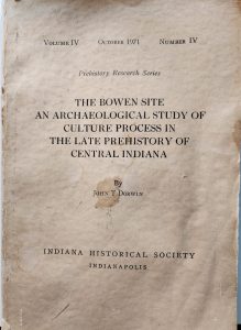
More about the Bowen site can be found here, including a photograph of reconstructed pottery. 

Shawndra Miller

Communications Manager

Shawndra is in charge of sharing our story and connecting you to our work. Through our print and online materials, she hopes to inspire your participation in protecting special places for future generations.
White River view in winter

Honoring the Myaamia, the “Downstream People”

Part 1 of a series for Native American Heritage Month

When we talk about CILTI nature preserves, we often focus on very recent history. We note names of individuals or families who had the foresight to work with the conservation community. We are indebted to all those who contributed to the effort to permanently protect these special places.

However, we know that the history of land stretches back so much farther. The tribal nations, people whose lives were inextricably linked to the land, often go unmentioned.

Myaamia were early stewards of much of our service area here in Central Indiana. The anglicized name for this tribe is the Miami Nation.

The Miami Tribe of Oklahoma notes that Myaamia means “the Downstream People,” reflecting the riverine origins of the tribe’s history.

According to Scott Shoemaker, a member of the Miami Tribe, the tribe’s origin story references a confluence along the St. Joseph River. The ancestors emerged from the river and grasped tree limbs to pull themselves out. “We became the Miami people through this transition of lifting ourselves out of the river,” he said during a recent interview.

The exact place is unknown. It may have been the St. Joseph confluence with the Elkhart River or with Lake Michigan in Benton Harbor, MI. From there, the people moved down the Wabash River valley and built communities at major confluences from Fort Wayne southwest to Vincennes.

Shoemaker, who is the former curator of Native American art, history, and culture at the Eiteljorg Museum, appeared on a recent White River Alliance podcast. He joined George Ironstrack, citizen of the Miami Tribe of Oklahoma, who serves as assistant director of education in the Myaamia Center at Miami University.

Ironstrack noted that the Myaamia began to cede their homelands in the 1790s. For the next 50 years, they were forced west of the Mississippi, a removal that fragmented the people. About 150 people were allowed to remain in Indiana while many more were forcibly relocated to Indian Territory (now Kansas). Eventually they were forced to move again, into present-day Oklahoma, while some stayed behind in Kansas.

This forced removal unfolded alongside the altering of land and water, as wetlands across the region were drained, rivers channelized, forests clearcut, and canals dug. Colonization caused irreparable harm both to the native people and to the land they had stewarded since time immemorial.

The Myaamia language, which weaves relationships into place names, emphasizes how crucial water is to the people.

As Ironstrack says, “The flow of water carries living things… We live in a landscape you could call a waterscape, and the rivers are like veins or arteries moving through our homelands and our people.”

Situated as it is along the White River, it’s a safe bet that Oliver’s Woods was home to the Myaamia after the people moved south from Lake Michigan. Historians place this southward movement in the early 1700s.

But because of archeological records, we have documentation of very early residents from hundreds of years before that. In Part 2, we will explore that earlier history.

Further Exploration:

History of the Miami People (Miami Nation of Oklahoma website)

A Myaamia Beginning, by George Ironstrack

Miami Nation of Indiana 

Shawndra Miller

Communications Manager

Shawndra is in charge of sharing our story and connecting you to our work. Through our print and online materials, she hopes to inspire your participation in protecting special places for future generations.
Nuthatch, by Jerry Rushton

The Land Protection Legacy

As we approach Thanksgiving, I want to recognize some of CILTI’s unsung but most gracious heroes—the members of our Burr Oak Society. Members I am truly thankful for.

Burr Oak Society members have prioritized the future of Indiana’s natural spaces for decades to come. These generous folks have such a passion for land protection that they included CILTI in their estates and wills. Continue reading

Stacy Cachules

Chief Operating Officer

Among her many key duties as Assistant Director, Stacy has the critical task of tracking our budget, making sure we channel donations for maximum efficiency. When her workday’s done, Stacy loves to spend time with her two young boys—and when not traveling, she’s likely planning the next travel adventure.
Carmel Creek

Visitors to Oliver’s Woods Nature Preserve can share photos for timelapse project

FOR IMMEDIATE RELEASE

Visitors to Oliver’s Woods Nature Preserve on the northside of Indianapolis can participate in a citizen science project that will show changes at the preserve over time.

Participants can take a photo of Carmel Creek from the designated spot in the nature preserve and email it to Chronolog, the platform that is creating the timelapse using the submitted photos. View the timelapsed photos here.

Over time, looking at multiple photos taken from the same spot will reveal seasonal changes, as well as changes in water levels and, potentially, wildlife population.

“Changes in the environment are sometimes difficult to see and understand because they happen gradually,” said Cliff Chapman, executive director of the Central Indiana Land Trust, Inc. (CILTI), which owns and manages Oliver’s Woods. “This project helps connect people with the subtle changes.”

Located at 8825 River Road, Oliver’s Woods features 16 acres of woods, 37 acres of prairie-savanna restoration, and a mile of White River frontage. Many volunteers have helped build trails, plant native plants and trees and remove invasive species from the property. This special care is allowing native species like wild ginger, rare butternut trees, waterleaf, wild hyacinth and trillium to flourish. The southern half of the popular Town Run Trail Park is encompassed within this property.

Watch our own Grace van Kan, White River Steward, share more about this project on Fox59!

Jen Schmits Thomas

Media Relations

An award-winning communicator and recognized leader in Central Indiana’s public relations community, Jen helps us tell our story in the media. She is the founder of JTPR, which she and her husband John Thomas own together.
Paddling the Boundary Waters Canoe Area Wilderness

Exploring the Boundary Waters

by David Barickman, Development Systems Manager

Vibrant night skies. Silent stretches of water. Bald eagles, loons, beavers. And total peace.

That was my experience of the Boundary Waters Canoe Area Wilderness (BWCAW) last month.

That first day, as my father and I paddled away from the outfitter’s dock and across Seagull Lake, it was apparent we were leaving several things behind. Much farther south, on our drive, we had left deciduous trees behind. More recently in Grand Marais, we had left cell phone signal behind. Now we were paddling away from access to extra supplies, our car, and many other conveniences.

We paddled a little further, and we left the last house and road behind as we passed a sign welcoming us into the official wilderness area.

What is wilderness? Wilderness can mean many things, but the U.S. Forest Service’s definition of wilderness is: “an area where the earth and its community of life are untrammeled by man, where man himself is a visitor who does not remain.”  This was written as part of the Wilderness Act of 1964, legislation that preserves the BWCAW and 803 other wilderness areas that encompass a total of 111.7 million acres.

The BWCAW is an expansive wilderness area in northern Minnesota stretching along 150 miles of the border between the United States and Canada. Its eastern edge lies close to the shores of Lake Superior. The BWCAW is just over 1 million acres and is made up of forest and 1,175 lakes. Canoe routes through the BWCAW exceed 1,200 miles.

Extending this tract of protected forest to the north is Canada’s Quetico Provincial Park (1.17 million acres). To its west is Voyagers National Park (218,035 acres). The geology of the region is what is known as the Canadian shield, made up of large areas of exposed granite bedrock. The forest is part of the “North Woods,” where conifers dominate.

My trip to the BWCAW was five days long and was spent primarily on and around Seagull Lake on the eastern side of the wilderness. I first picked up my father in central Illinois where he lives, and we drove just over 700 miles north to Grand Marais, MN. From there, we headed into the Superior National Forest down the Gunflint Trail to Seagull Outfitters, where we rented our canoe and began our trip.

After passing into the BWCAW, beyond the “no motorized boats” sign, we paddled on several more miles to the far side of the lake to where we intended to camp. Our plan was to paddle and portage to nearby lakes each day.

Even as we left many comforts behind, it became clear we were gaining many benefits as we entered the wilderness.

Bald eagle

We began to see more wildlife each day. Each morning, a tiny red squirrel chattering at our tent woke us up. I flushed three or four startled grouse from the underbrush nearly every morning. We saw multiple bald eagles each day and paddled past many eagle nests. One evening, as I spent a few hours fishing, I was joined by a bald eagle perched about 100 yards away atop a dead pine. Another evening, during a late paddle, we saw no less than 10 beavers swimming around the calm bays of the lake. And of course, there was the iconic north country auditory backdrop of loons throughout the trip.

We also noticed more moments of peaceful quiet, or at least an absence of man-made noise. Noise pollution was low enough that, at times, when the wind was soft and the loons were calm, you could enjoy real silence. In that moment, you could pick up on fascinating sounds like the babbling of a riffle on a river far away or the lake softly lapping at the shore.

The night sky was also more vivid. The BWCAW is the largest designated Dark Sky Sanctuary. A Dark Sky Sanctuary is a place recognized for its exceptional starry nights and lack of light pollution by the Dark Sky Association. Each night before we turned in, we would marvel at the vibrant sky filled with more stars than we had ever seen. Just a few nights after we left the BWCAW, the Northern Lights treated other visitors to a brilliant display.

We also enjoyed the solitude, which provided a welcome rest from daily life. I wouldn’t say I live a hectic or chaotic daily life. However, modern life puts constant demands on a person’s attention and focus. In the BWCAW, my phone received no notifications, no one was trying to get my attention (other than our constant friend the red squirrel), and I had nowhere to be. This, for me, was restorative.

While I would certainly advocate that anyone remotely interested in a wilderness experience make a trip to the BWCAW, it is not the only way you can access some of these benefits. In many ways, wilderness could be seen as a juxtaposition of the modern drive towards development. In that way, there are many pockets of wilderness that hold treasures for you to enjoy. There are many here in Central Indiana! Nature preserves can be a wonderful place to clear your schedule, turn off your phone, and enjoy a small slice of wilderness close to home.

If you would like to learn more about the BWCAW, I would suggest checking out Friends of the Boundary Waters Wilderness.

David Barickman

Development Systems Manager

Born and raised in Central Illinois, David spent many days as a child wandering around the river, forest and lakes there. He works behind the scenes as a key member of our fundraising team. When not working, David loves to be outdoors hiking, fly fishing, kayaking or woodworking.
Bison at Kankakee Sands

CILTI Founder Earns Prestigious Award

Ellen Jacquart started a career in conservation with no roadmap. While she was following her interests in higher academia, she never could have imagined that one day she would have founded a land trust, managed stewardship for The Nature Conservancy in Indiana, or worked successfully to ban the sale and trade of invasive plants. Continue reading

Shawndra Miller

Communications Manager

Shawndra is in charge of sharing our story and connecting you to our work. Through our print and online materials, she hopes to inspire your participation in protecting special places for future generations.
Fred and Dorothy Meyer Nature Preserve in autumn

Your Generosity Doubled our Reach!

We are thrilled to announce that we met our match challenge grant, with the help of caring supporters like you! Thanks to your generous donations over the summer months, we received a $50,000 matching challenge grant. Our board member and friend, Stephen H. Simon, stepped up with this challenge—and you responded in a big way. Continue reading

Shawndra Miller

Communications Manager

Shawndra is in charge of sharing our story and connecting you to our work. Through our print and online materials, she hopes to inspire your participation in protecting special places for future generations.
Chimney Tops, Great Smoky Mountains National Park

Bear Country

This is the final installment in a series by White River Steward Grace van Kan. In part 3, Grace toured the Appalachian Bear Rescue facility. The story concludes…

Within the Great Smoky Mountains National Park are an estimated 2,000 to 2,400 bears, and potentially 14,000 in North Carolina alone. They persistently return to their natal range: Appalachian Bear Rescue curators conducted research showing that bears travel outside of the home range for food, but always return. Additionally, bears that are removed from their home range will find their way back, even from out of state!
Continue reading

Grace van Kan

White River Steward

Grace grew up roaming the woods, creeks and wetlands around the Chesapeake Bay watershed. From an early trout-raising project to a “gap year” spent restoring coral reefs in Thailand, her interest in aquatic conservation has only grown. Now she cares for several riverine nature preserves as CILTI’s White River Steward.
Bear biologist David Whitehead shares Appalachian Bear Rescue's enrichment area

How to Rescue a Bear (with Appalachian Bear Rescue)

Third in a series by White River Steward Grace van Kan. In part 2, Grace described the “bear necessities” of black bears, as imparted by biologist David Whitehead. The story continues…

Much to our surprise, David brought us to the Appalachian Bear Rescue facility for a tour. We were allowed to visit because there were no bears being rehabilitated or housed in the facility at that time. ABR emphasizes restricting human contact with the bears to the absolute minimum. Continue reading

Grace van Kan

White River Steward

Grace grew up roaming the woods, creeks and wetlands around the Chesapeake Bay watershed. From an early trout-raising project to a “gap year” spent restoring coral reefs in Thailand, her interest in aquatic conservation has only grown. Now she cares for several riverine nature preserves as CILTI’s White River Steward.
Grace in the Great Smoky Mountains National Park

Bear Necessities

Second in a series by White River Steward Grace van Kan. In part 1, Grace described the dramatic first sighting of black bears. The story continues…

The next day we were due to meet with bear biologist David Whitehead, a curator at Appalachian Bear Rescue (ABR). Rehabilitating their first bear in 1996, ABR is an organization that rescues and rehabilitates orphaned and injured black bears. David is a wealth of knowledge and experience, sharing the history of black bears in the park and neighboring states. He also provided what I found to be a very enlightening lesson on bear biology. Continue reading

Grace van Kan

White River Steward

Grace grew up roaming the woods, creeks and wetlands around the Chesapeake Bay watershed. From an early trout-raising project to a “gap year” spent restoring coral reefs in Thailand, her interest in aquatic conservation has only grown. Now she cares for several riverine nature preserves as CILTI’s White River Steward.